When we left the hotel at 6:45 am, the temperature was 36* and we had to scrape the windows again. We decided to head north first and drive through Firehole Lake Drive. It was only about 5 miles north of where we were staying.
North of Old Faithful
Along the road
Along the road
Firehole Spring
Surprise Pool
Just past Surprise Pool is the Great Fountain Geyser. The eruptions of this geyser average over 100 feet, with occasional super eruptions going over 200 feet. The interval between eruptions is 10-14 hours. Once the eruption does start it typically lasts 45 to 60 minutes. The pool overflows and boils violently when an eruption is imminent.
Great Fountain Geyser
It's easy to spot the White Dome Geyser's massive cone. This enormous buildup shows that this geyser has been around for a long time, and it has nearly sealed itself closed. Eruptions are around 30 feet high, and usually last only a minute or so.
White Dome Geyser
A creek running through Firehole Lake Drive
Firehole Lake is the largest hot spring in this area. Large mats of warm water bacteria, called thermophiles, lie underneath, creating the unusual brown color.
Firehole Lake
Firehole Lake
Along the drive
We saw lots of these signs.
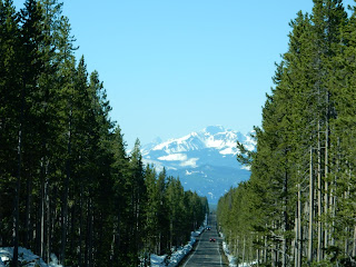
From here, we head south again. The scenery is beautiful and it's a bright, sunny day.
Not sure if there was a fire here or the steam or
geysers killed the leaves on these trees.
We made a quick stop at Kepler Cascades, a waterfall on the Firehole River. The cascades drop approximately 150 feet over multiple drops. The longest drop is 50 feet.
Kepler Cascades
I had to stop and have Conrad get out to stand by the snow pole to show everyone how tall it is. Conrad is 6'2" tall and the pole is much taller. These show the snowplows where the edge of the road is located.
Conrad and the snow pole
Isa Lake is at Craig Pass on the Continental Divide at 8,262'. Most of it was still frozen and there was quite a bit of snow around.
Isa Lake
Isa Lake
Continental Divide near Isa LakeAbout 5 miles down the road, we crossed it again.
Lots more snow here!
Close to the West Thumb area
And crossed it a third time south of West Thumb
at 7,988 feet!
So much snow in this area
Near the south entrance of Yellowstone. You
can see the Grand Tetons in the distance.
By 9:15, we entered Grand Teton National Park. Once again, I have no words for the beauty of the Grand Teton Mountains. We were so lucky to have a beautiful, sunny day to see these mountains. We didn't make too many stops.
Here we are at the park entrance
Jackson Lake is a natural lake and was enlarged by the construction of the Jackson Lake Dam, which was originally built in 1911, enlarged in 1916 and rebuilt by 1989. The top 33 feet of the lake is utilized by farmers in Idaho for irrigation purposes. The lake is the remnant of large glacial gouging from the neighboring Teton range to the west and the Yellowstone Plateau tot he north. The lake is primarily fed by the Snake River, which flows in from the north, and empties at Jackson Lake Dam. Jackson Lake is one of the largest high altitude lakes in the U.S., at an elevation of 6,772 feet above sea level. The lake is up to 15 miles long, 7 miles wide and 438 feet deep. The water of the lake averages below 60*, even during the summer.
Jackson LakeGrand Teton Mountains
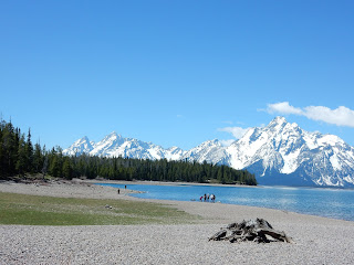
Jackson Lake and the Grand Tetons
Here's a video of the Jackson Lake area.
Grand Tetons
Grand Tetons
Grand Tetons
The Snake River originates in Yellowstone and runs through the park. We stopped at Snake River Overlook and ate a picnic lunch here.
Snake River
The Grand Tetons and the Snake River
Grand Teton is the tallest peak at 13,770'. The area between Middle Teton and Grand Teton is called Lower Saddle.
The peaks from left to right are South Teton,Nez Perce, Middle Teton, Grand Teton, Mt
Owen and Teewinot
Ski area in Jackson, WY
Since we had the time, instead of our original plan to backtrack through the park and through Yellowstone to the west entrance in the town of West Yellowstone, we decided to take the Teton Scenic Byway on the back side of the mountains. The road was very curvy and mountainous, but it was a beautiful drive.
It wasn't long until we crossed the border in to Idaho. The Wyoming sign was right across the road from the Idaho sign so we were able to get both of those pictures.
Finally got to visit Idaho!
Conrad in Wyoming
We continued on with no stops until we got to West Yellowstone, Montana. This is the west entrance to Yellowstone. The land seemed to change often along this road.
I don't know why they have to make the sign
so ugly with all those stickers.
Our tiny room
Our friends, Stan and Debbie Jones, were working for the summer in Island Park, Idaho, about 15 minutes from where we were staying. They live in an RV full time and travel all over the U.S. We met them for dinner that night at Cafe Madriz in West Yellowstone. It was a fun time that went too fast. We stayed at the Madison Hotel and it was the smallest room we've ever had. The price, including tax, was $122.00. It wasn't too bad of a day with only 7,692 steps!


No comments:
Post a Comment