Day 10 - Thursday, April 28, 2022
We checked out of the motel in Moab about 7:30 and headed to the Needles District of Canyonlands National Park. It's such a pretty drive on this road. Our first stop was Newspaper Rock, on a side road that leads into the park. Newspaper Rock is a petroglyph panel etched in sandstone that records approximately 2,000 years of early human activity. Prehistoric peoples, probably from the Archaic, Basketmaker, Fremont and Pueblo cultures, etched on the rock from B.C. time to A.D. 1300. In historic times, Ute and Navajo people, as well as European Americans made their contribution.

The road south, leaving Moab

Newspaper Rock

Newspaper Rock

Newspaper Rock - and Conrad

Newspaper Rock

Road leading into the Needles District

Road leading into the Needles District

Road leading into the Needles District

Road leading into the Needles District - You can see
the Six Shooter Peaks that we saw from the Needles
Overlook area.

Canyonlands National Park

Wild flowers along the Roadside Ruin Trail
The trail led to a Puebloan granary.

Roadside Ruin Trail
We saw lots of cactus everywhere on this trip.

This is one of the region's many granaries, used by various
Native American cultures who cultivated corn, beans and
squash when the climate in the area was wetter You can
find these granaries and other evidence of the Puebloan
societies all over the Canyonlands region, but this granary, built
sometime between 1270 and 1295 CE, is particularly well-preserved.
It is also unique in that it's accessed via a door on top of the
granary instead of the sides.

We saw a large area of these mushroom-like rocks.

More mushroom-like rocks

A raven - Conrad's favorite bird. I can't tell
you how many times I saw him taking pictures
of them!

Next up was the Cave Springs Trail. This was also
an easy one for the most part. You'll see why later!
The Cave Springs trail passes Cave Spring, one of the area's few year-round water resources. An excellent natural campsite, this location contains evidence of almost 1,000 years of human use. You can see evidence of a cowboy camp in the first alcove, which served as an open-air bunkhouse. Cowboys lived in isolated camps like these from the 1890s until 1975, when cattle ranching was discontinued in Canyonlands. Beyond the cowboy camp, there is evidence of earlier human use, including rock paintings, grinding slicks and a smoke blackened ceiling.

Cowboy camp

The camp would have looked like this. You can
see the smoke blackened ceiling.

The bottom brown spot is the spring.

Close-up of the spring

Grinding slick - used to grind corn and
other foods

Rock paintings

This is where we turned around. You had to climb
TWO ladders to make it a loop trail. The park ranger
said this ladder was easier than the second one!

Wooden Shoe Arch
The Needles - The surprising secret of this striking landscape is the presence of salt. The story begins 300 million years ago with an immense salt layer left by the ancient seas. Today it lies over 1,000 feet below us. Over time, coastal sand dunes and sediments from eroding mountains buried the salt. The crushing weight of overlying rock caused salt to flow like cold molasses. This movement fractured brittle sandstone into a grid-like pattern. Erosion along these fractures slowly created the spires, fins, buttes and canyons of the rugged landscape.
To get to the area where you could see The Needles up close, you had to take a sort of rough, dirt, sand, narrow (only one lane in spots), and curvy road. It was worth the drive! There were so many interesting formations in the area.

The Needles

The Needles

In The Needles area

In The Needles area

In The Needles area
The Elephant Hill area was crowded and interesting. There was a road here only for four-wheel drive vehicles and mountain bikes. You had to have a permit to drive the road. It is considered one of the most technical four-wheel drive roads in Utah. Elephant Hill presents drivers and mountain bikers with steep grades, loose rock, and stair-step drops. Extremely tight switchbacks require backing up.

Elephant Hill and parking area

Elephant Hill - you can see a white car sort of in
the middle of the picture. It was fun to watch the
vehicles for awhile.

Elephant Hill Road
Pothole Point had a short loop trail that crossed sandstone dimpled with potholes. The hike follows a string of cairns over slickrock. The potholes trap water after a desert rain. The rainwater is mildly acidic and ever so slowly enlarges the pothole. An intricate, symbiotic animal community featuring shrimp, worms, and snails are found in some potholes. Over time the wind continuously blows dirt, sand and small bits of organic material into the potholes. Eventually plants take root in the thin layer of soil.

Pothole Point Trail

See the swirls in the rock!

Lots of cactus here!

Lots of potholes

More potholes

These rocks are huge! You can see Conrad
standing on top of the one on the left.

This was in the Slick Rock Trail area.

Slick Rock Trail area

Leaving the Needles District

Church Rock near Monticello, UT - 200 feet tall
We stayed at the Wayside Motor Inn in Monticello, UT tonight. We walked across the street to Gustavo's Mexican Restaurant. It was really good and was a little different than most Mexican restaurants. Maybe it was more authentic food. I would love to have had the salsa recipe!
Day 11 - Friday, April 29, 2022
We only drove 152 miles today but we packed a lot in to those miles and saw some really cool stuff! We left the hotel just before 7:00. We were looking for Mule Canyon Ruin and thought we found it but it was Butler Wash Indian Ruins. We talked to a guy in the parking lot about it and he said it was worth the 1 mile hike, round trip. So, off we went. At first we followed a sandy trail but then it turned in to a slickrock trail. It was definitely worth the hike! Butler Wash Ruin is a cliff dwelling that was built and occupied by the Ancestral Puebloans, sometimes known as Anasazi, in about 1200 AD. Parts of the site have been stabilized and reconstructed, but most of it remains as it was found in the 1800s. There are habitation, storage and ceremonial structures, including four kivas.

There are lots of places to camp in the
middle of nowhere.

It was a beautiful drive west of Bluff, UT.

Loved this cut in the road!
WOW!

You can really see how dry it is here. This is
on the trail to Butler Wash Ruins.

So many beautiful desert flowers along the trail!

This tree is trying so hard to grow
from this rock.

Butler Wash Ruins

Butler Wash Ruins

Butler Wash Ruins

Butler Wash Ruins

Butler Wash Ruins
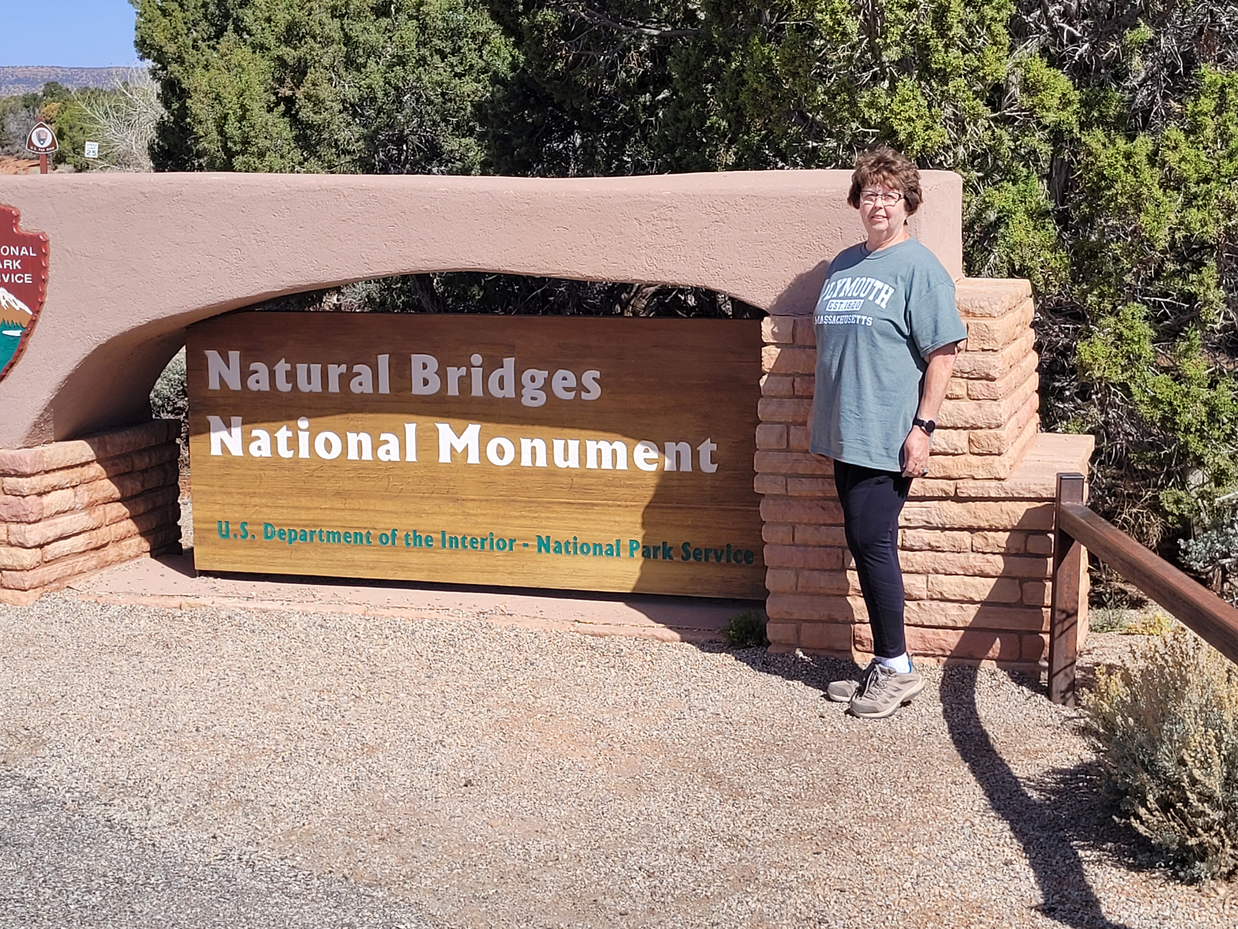
Then we were off to find Mule Canyon Ruin. Mule Canyon Ruin is a small Anasazi village, used for living quarters and religious ceremonies. The masonry structures now visible were constructed of sandstone blocks and set in wet soil mortar. During occupation, the walls of the structures (except the kiva) were higher, and all were roofed. The roofs consisted of a log frame, covered with progressively smaller limbs and sticks, then sealed with soil mortar. The floors of all the structures consisted of hard-packed soil.


Next stop was at Natural Bridges National Monument. About 260 million years ago, the area of Natural Bridges was a beach of dazzling white sand, shoreline to the sea covering eastern Utah. Over time, water spread and receded, depositing layers of sand, silt and mud. Today, visitors can spot these stacked layers, or rock strata on canyon walls. About 10 million years ago, plates colliding below the surface pushed these layers upward. This uplift was incredibly slow, about 1/100th of an inch per year. This area is now a high desert called the Colorado Plateau. After uplift, the Colorado River and its streams cut into the plateau and created winding canyons. Some streams wound back and forth in folds like ribbon candy. Thin canyon walls separated the different turns. As water pounded against these walls, eventually the rock crumbled. This left thin natural bridges of rock above the newly made streambed.

bridge and an arch.  Sipapu Bridge

This bridge is 220 feet tall with a span of 268 feet,
31 feet in width and 53 feet in thickness. It is the
second largest natural bridge in the U.S.


 Kachina Bridge - We were a little disappointed to

The trail to Kachina Bridge

The trail to Kachina Bridge

have walked this moderate trail then it's still hard
to see the bridge. It is 210 feet tall, with a span of
204 feet. It is 44 feet wide and a thickness of 93 feet.
 The Owachomo Bridge from the viewpoint. It's kind

of hard to see from this picture. It was so windy here
it was hard to stand up! The wind gusts were about
50 to 60 mph! We decided to walk on down
and get a closer look. They said it was a half mile
hike round trip but I think it was further!
 Conrad took a picture of me trudging down the trail

to the Owachoma Bridge..It was mostly a rock trail
but also lots of uneven stairs.

of 180 feet. It is 27 feet wide and a thickness of 9 feet.
 Owachomo Bridge is the smallest and perhaps

oldest bridge in the park.
 Owachomo Bridge


Coming back up the trail - a view of the overlook
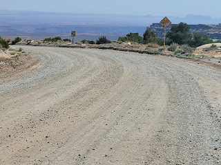
Muley Point was next on the list. The overlook here provides a panoramic view of the Goosenecks of the San Juan River, and the vast, sweeping valleys of the desert valley below. There was no mention of "turn on to the gravel road"! First, we passed by Bears Ears National Monument, a pair of towering buttes standing against beautiful scenery. This area includes red rock, juniper forests, high plateau and an abundance of early human and native American historical artifacts. The Navajo Nation, Ute Mountain Ute Tribe, Hopi Nation and other tribes are extremely tied to this land.
We talked to a couple at Muley Point who lived in Phoenix. They guy was standing by his car, chowing down on a leftover rib from the night before!. He'd say something to us and then take another bite!


and went back to the highway but it was worth
the trip when we saw the view!
 Muley Point


hard around here.
 Muley Point
 Muley Point

 Here we go!
 It was a good gravel road.
 Moki Dugway view
 Moki Dugway view
 Moki Dugway view
 Moki Dugway view
 A view of the GPS
 Valley of the Gods
 Valley of the Gods


Muley Point
Muley Point
After Muley Point, we headed to the Moki Dugway. I had really been looking forward to this part of the drive. The Moki Dugway is part of Highway 261. It is a staggering, graded dirt switchback road carved into the face of the cliff edge of Cedar Mesa. It consists of 3 miles of steep, unpaved, switchbacks (11% grade), which wind 1,200 feet from Cedar Mesa to the valley floor near Valley of the Gods. There are views of Valley of the Gods, stripes of color in the rocks of the San Juan River Canyon known as the Navajo Tapestry and distant Monument Valley. It was a fun drive and I got Conrad to video part of the trip but it is too long to put on here.


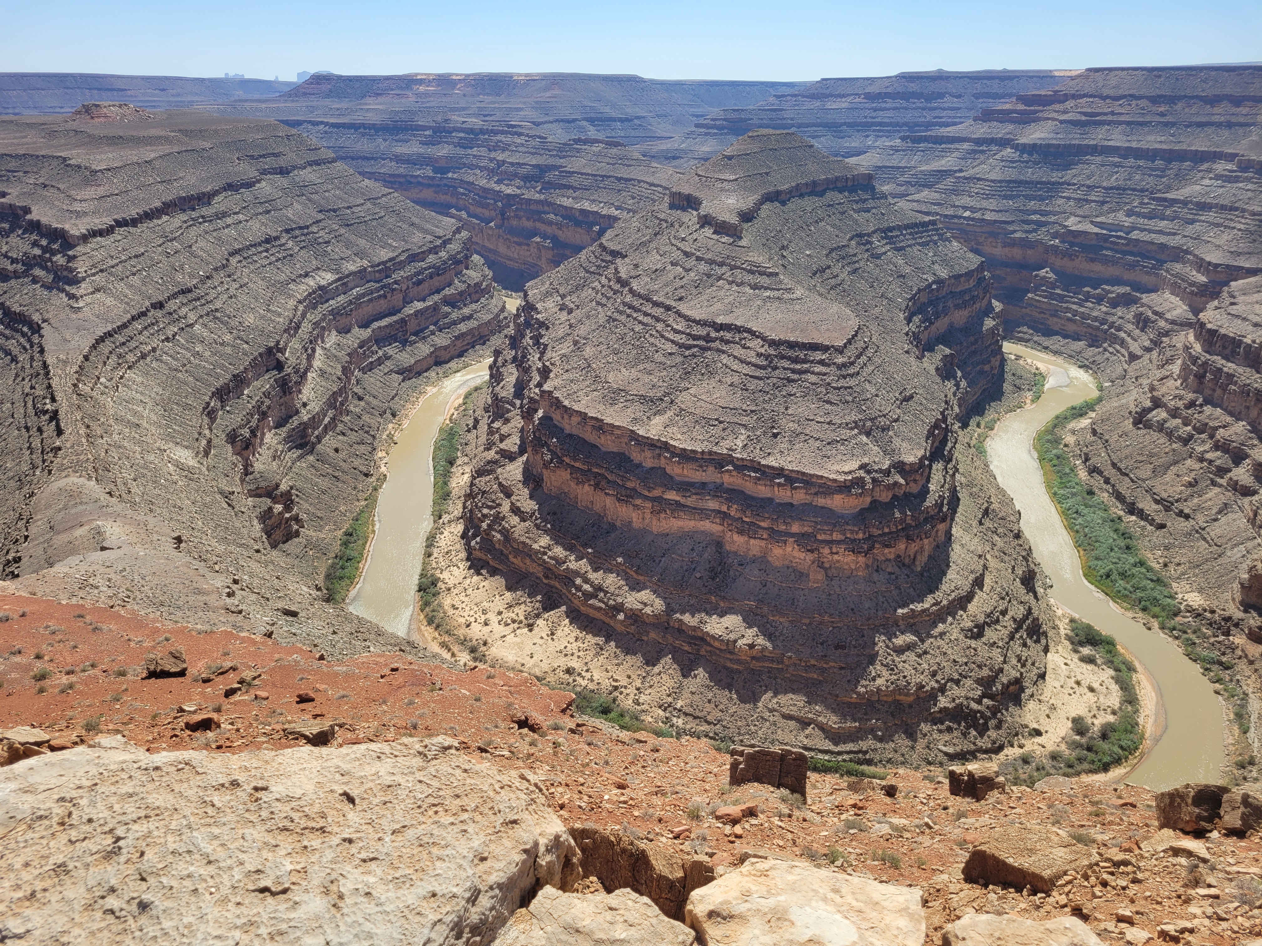
Our last stop of the day was at Goosenecks State Park. There was a $5.00 per car admission fee. We stopped at the gate to pay and the lady took our money and said "Straight ahead." Well, straight ahead was the parking lot and there wasn't any more to the park! But, the view was fantastic! Over a distance of one and a half miles, the San Juan River flows for more than six miles through the twists of the entrenched meander on its way to Lake Powell. This is the result of 300 million years of geological activity, where the San Juan River winds and carves its way through the desert 1,000 feet below.


Rapley Ridge, near Mexican Hat, UT - The locals
have described it as resembling the design of a
"Navajo blanket." The zig-zag pattern is caused by
runoff-induced differential erosion, cutting deep gouges
and gullies that expose the many layers on the western slope.
I just called them the Charlie Brown mountains!


formations, balances a flattened pancake disk atop a
300foot high talus cone. It's not really a hat at all, but
a sombrero with a wide brim jutting above a narrow
head. Lots of people have climbed this rock!
 The view from our motel - The San Juan Inn

We had a second floor room and a view of the river.
 The San Juan River from our motel room.
 San Juan Inn - Mexican Hat, Utah


We stayed two nights at the San Juan Inn in Mexican Hat, Utah. Mexican Hat had a population of 31 in 2010. There were two motels and maybe three restaurants but one was closed. There was a restaurant at our motel but the menu didn't look too interesting. We decided on the other one that was open, The Swingin' Steak. It was outdoor dining only and about six tables. The guy cooking on the swinging grill was very friendly and drinking a beer while he cooked. He keep the grill swinging the whole time we were there. The freezer and refrigerator were out there and when we left I asked the guy if they had any problems with people stealing food from there. He said, "No, we have lots of cameras and if anyone tried it, we'd have their asses by morning!"

The menu

The food was put on the sizzling hot plate. I thought
the salad wouldn't be good on the hot plate and on
top of hot beans but it was really good!

official post office! Gas was $4.59.
Day 12 - Saturday, April 30, 2022
We left the motel before 8:00 and drove about 20 miles to Monument Valley. On the way there, we stopped at the place where Forrest Gump ended his run across the country. Lots of people were stopped there, taking pictures in the middle of the road. It's a beautiful drive and we stopped at all the pull over places to take pictures. Sorry for the picture overload but the scenery today was amazing!

Monument Valley

Monument Valley - This is where Forrest Gump
ended his cross country run. It was a busy place!

Monument Valley

Monument Valley

Monument Valley

Monument Valley

Monument Valley at Goulding's Lodge

Monument Valley - at John Wayne's Cabin -
The exterior of this building was used in the movie
"She Wore a Yellow Ribbon" as the home of Captain
Nathan Brittles, played by John Wayne.

Monument Valley - The museum at Goulding's
Lodge had a lot of memorabilia from the many
movies filmed in the area.

Monument Valley - Museum at Goulding's Lodge

This mountain was just behind Goulding's Lodge in
Monument Valley

Monument Valley - Museum

Monument Valley - museum

Monument Valley - museum
Schedule for day 72 of 90 (12/1/1989) for filming
"Back to the Future Part III"

Driving around Monument Valley area

Crossed over to Arizona (state #6) for
a bit. Then headed back to Utah.

Monument Valley

Monument Valley - pretty dreary here

Monument Valley

Monument Valley - A Hogan in the yard of a local
family. Hogans are used for special ceremonies.
Many of the houses had one in their yard.

Monument Valley - A Hogan

Monument Valley - Back to Utah
We had booked a tour of Monument Valley through Goulding's Lodge. It was about a 3 hour tour. We were glad we didn't drive our car through the 17 mile loop through here. The road was dirt, dust, bumpy and bumpier. We rode in bench seats in the back of a pickup truck with a cover over us. Our guide would put down steps for us to get in and out. It was awfully windy. There were only 9 of us in our group. The other vehicle that left when we did probably had 16 people on it. Masks were required, even outside, anywhere on Navajo properties.

Monument Valley - West Mitten Butte (also
called Left Mitten Butte)

Monument Valley - You can kind of tell how huge
all the monuments are when you see the road
and the cars.

Monument Valley

Monument Valley

Monument Valley - Three Sisters and Mitchell Mesa
The name Three Sisters refers to the sisters of the Catholic
Church that would give lessons to pupils. The taller spires
are 1,000 feet tall.

Monument Valley - Three Sisters

Monument Valley - Elephant Butte
Monument Valley


.jpg)


Merrick Butte is 6,206 feet tall.
 Monument Valley - Our "bus"
 Monument Valley
 Monument Valley
 Monument Valley - Cly Butte
 Monument Valley
.jpg) Monument Valley
Monument Valley
 Monument Valley
 Monument Valley
 Monument Valley - Our motel in Mexican Hat


.jpg)


is below the mountain.
 The San Juan River in Mexican Hat, UT, below

our motel.
We felt so dirty and dusty when we got back to our room about 5:30 pm. I could feel the dirt in my hair and couldn't wait to take a shower! We stopped at 7-Eleven to gas up and bought a sandwich for myself and some pasta salad to share. We had a big lunch at Goulding's Lodge and I had some leftover fish that we brought back and Conrad had it for dinner.
Day 13 - Sunday, May 1, 2022
Left the motel at 6:50 a.m. headed to the Four Corners area. We had to drive through Monument Valley again and we enjoyed seeing it again. We saw an Indian walking down the road in the middle of nowhere, wearing a mask. The Native Americans are very serious about wearing masks. Our first stop was at the Four Corners Monument. Here you can stand in Arizona, Colorado, New Mexico and Utah. In 1992 the monument was refurbished and a bronze disk was embedded in the granite. Each of the state boundaries radiate from the disk and each state's seal rests within that state's boundary. It's kind of a cheesy thing but one of those things you have to do! So, each stood in the center, took a picture, walked by the "shops" and I bought a magnet. Then it was back on the road.


Four Corners Monument - Linda


 Taken in Four Corners Parking Lot
 We saw this car in the parking lot at Four Corners.

Four Corners Monument

State #6


While writing this blog, I looked this guy up. His name
was Jesse Boz and he was from Brazil. He was driving from
Brazil and through the U.S. to Florida, up the east coast then
on to Chicago, Route 66 to Santa Monica, CA then up the
west coast on the way to Alaska. He and his dog were killed
in a car accident on May 22, just 3 weeks later near Salem, OR.
He had driven 52,000 miles and drove through 17 countries.
 Not much to look at here.
 Not exactly colorful, but back to Colorado - #4.


Mesa Verde National Park was established in 1906 to preserve and interpret the archeological heritage of the Ancestral Pueblo People who made it their home for over 700 years, from 600 to 1300 CE. Today the park protects nearly 5,000 known archeological sites, including 600 cliff dwellings.
We stopped at the Visitor Center, just inside the park for information and souvenirs and then headed to the back part of the park. It takes 45 minutes to drive to the back of the park with no stops so it took us longer to get there! The museum was closed until July 1st so we didn't get to see it.


permanent structures built on the mesa. Though
nomadic people lived in the surrounding area for
thousands of years, permanent farmsteads began
to appear on the mesa around 550.
 Mesa Verde Park - Navajo Canyon View - At 7,000

feet, it might seem like a high place to farm. However,
the southward slope of this plateau provides more
sunlight and warmth, lengthening the growing season.
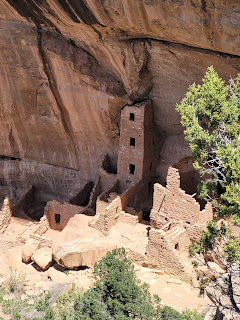
 Mesa Verde Park - Square Tower House - This cliff

dwelling includes the tallest standing architecture in
Mesa Verde, a four-story, 27 foot tall structure that was
part of an even larger building complex. 90% is original.
 Mesa Verde Park - Square Tower House
 Mesa Verde Park - Square Tower House
 Mesa Verde Park - Square Tower House
 Mesa Verde Park - Pit House - These are the remnants


of an evolving village and the beginnings of a new style
of home. The original village was composed of both pit houses
and above ground rooms made of jacal - a wooden lattice
plastered with mud with larlge stone slabs supporting the base.
 Mesa Verde Park - Mesa Top Sites - At this site there

are 3 villages built one on top of another. The people of
the first village constructed their homes of jacal. Later
occupants built a second village on the same site with
single-stone-wide sandstone masonry. A third village,
built around 10775, represents a major innovation with
its use of double-stone, rubble-core masonry - two outer
walls with soil and rock fill between them.


the last mesa top pueblos to be built at Mesa Verde, a
30-room village with a large kiva and tower connected
by a tunnel at its center.
 Mesa Verde Park - Sun Point Pueblo

 Mesa Verde Park - Sun Point View
 Mesa Verde Park - Oak Tree House - Like other cliff


Mesa Verde Park - Sun Point View - Over 30 cliff
dwellings occupy these canyon alcoves and ledges.
Mesa Verde Park - Sun Point View - This place was amazing
and it was fun looking for all the cliff dwellings.


dwellings, Oak Tree House is tucked neatly into an
alcove that protects the village from wind, rain and snow.
Its southern exposure provided warmth from the low winter sun.
 Mesa Verde Park - A closeup view of Oak Tree House
 Mesa Verde Park - Fire Temple - The large open area at the


front of Fire Temple is much like the plazas at the center
of Pueblo communities today, where social and ritual activities
take place.
 Mesa Verde Park - Sun Temple - Archeologists excavated

24 rooms of various shapes and sizes as well as three
circular structures inside the main complex.

largest cliff dwelling, with 150 rooms and 21 kivas. In the summer,
you can tour this cliff house. The tour is with a ranger only and involves
120 uneven stone steps and climbing five 8 to 10 foot ladders on a
100 foot vertical climb!
 Mesa Verde Park - Cliff Palace
 Mesa Verde Park - Cliff Palace


It took us about 45 minutes to get out of the park then drive the few miles back to Cortez where we stayed at the White Eagle Inn. We stopped at Walmart to pick up some new yoga pants for me since I couldn't button my jeans with a broken thumb! I bought 3 new pair and we also picked up some more breakfast bars and Diet Coke. We had dinner at Main Street Brewery. I had a Native Taco - a taco on fry bread instead of a tortilla. It was different but good. Conrad had pulled BBQ pork.
Day 14 - Monday, May 2, 2022
We left the motel at 7:30 and our first stop was in Durango, CO. We walked the Main Street Historic Building walk and then drove by some of the old houses and churches.

Mancos, Colorado

Loved all the farms set back from the road -
Mancos, CO

Durango, CO

Durango, CO

Durango, CO - Built in 1892, this building was originally
Colorado State Bank and later became known as
the Burns National Bank Building.

Durango, CO - The building on the left in 1915 was The
Gem Theater. The building next to it has a cast iron and
pressed metal front made by Mesker Brothers of St Louis, and
probably came to Durango on the train. These early "pre-fab"
products were popular because they were durable, fire resistant
and less expensive.

Durango, CO

Durango, CO - Strater Hotel - Room 222 on the far
left in the part that sticks out, was where Louis L'Amour
wrote all his books. If you zoom in, the window is open.

Durango, CO - The Strater Hotel opened in 1887.

Durango, CO - The Strater Hotel is adorned with beautiful
handcrafted woodwork, period wallpaper, and the largest
collection of American Victorian walnut antiques.

Durango, CO - Strater Hotel

Durango, CO - Train Station
Durango & Silverton Narrow Gauge Railroad

Durango Train Museum

Durango, CO

Durango, CO

Durango, CO

Durango, CO
Our next stop was in Pagosa Springs. We ate lunch here at Rizz Razz Brewery. The restaurant was in an old house and really nice. We had a good lunch and then we drove over to the San Juan Riverwalk and walked along the river. We saw several people rafting through here. We watched one woman fall out of the raft but was able to crawl back on it. Jason tells us the water is about as cold as Spring River so I don't think we'd want to try it! We walked over to the area where the hot springs are and it was full of people.

Between Durango and Pagosa Springs

Pagosa Springs - Rizz Razz Brewery

Pagosa Springs - San Juan Riverwalk
A hot spring

Pagosa Springs - San Juan River

Pagosa Springs - San Juan Riverwalk

Pagosa Springs - Oops! Woman overboard!

Pagosa Springs - The Springs Resort - There are 25 naturally hot
therapeutic mineral pools fed by the ancient waters of the
World's Deepest Geothermal Hot Spring. The pool temperatures
range from 87* to 114*.

Pagosa Springs - The Springs Resort

Pagosa Springs - The Springs Resort

Pagosa Springs - The Springs Resort

Pagosa Springs - The Springs Resort
Chess, anyone?

Pagosa Springs - The Springs Resort
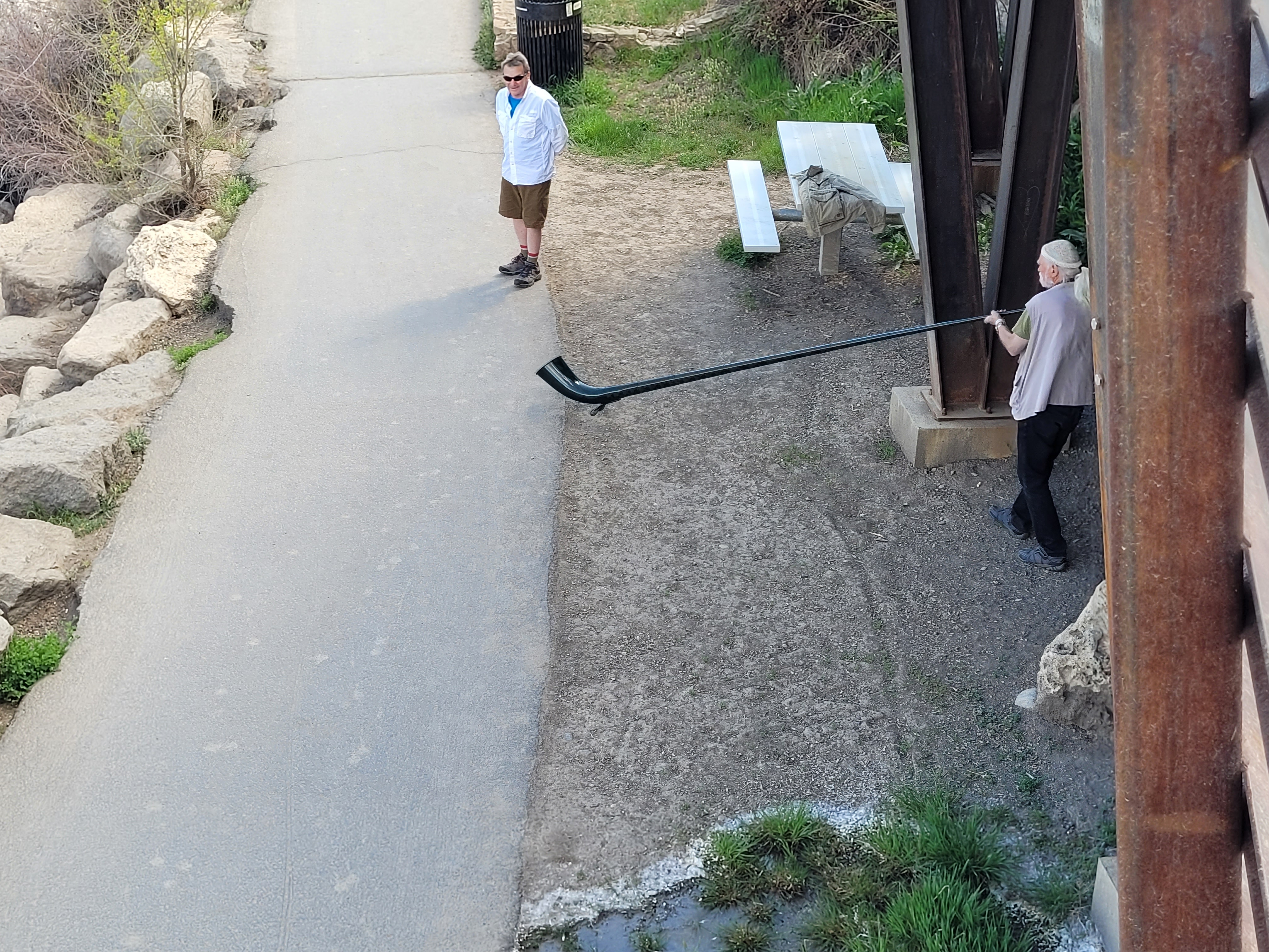
Pagosa Springs - This guy was playing his
alphorn along the Riverwalk.

Heading out of Pagosa Springs and we can see
the big mountains with snow on them again!

Treasure Falls near Wolf Creek Pass

Treasure Falls near Wolf Creek Pass
.jpg)
I asked a guy to take our picture at Treasure
Falls. After we checked in to our hotel I went
back to the office to get some ice and he was
checking in!
Treasure Falls

Snow melt was pouring off the mountains in so
many places.

Still lots of snow up on Wolf Creek Pass..jpg)


 Dinner in South Fork, CO at Mountain Pizza. They had
.jpg)
More snow melting

Lots of water here!

Lots of snow on Wolf Creek Pass

We made it to the top! We are on top of the
Continental Divide.

We wanted to go up to Lobo Point, but the road was
blocked with a 5 to 6 foot pile of snow! Maybe next trip!

a beer wall, something we've never seen. Can't say
much for the pizza though!
 On our way back to the hotel, 18 deer were

crossing the road.
We booked two nights at the Wolf Creek Ski Lodge in South Fork. We were here in 2007 with Conrad's brother Clyde and his wife Sandy and we loved the area. We decided to stay two nights so we could drive back up to Creede and some other sites.
Day 15 - Tuesday, May 3, 2022
We didn't leave the hotel until about 8:30 and headed up to Creede, a small town north of South Fork. Its population in 2020 was 357. It sits in a dormant volcanic caldera surrounded by sheer cliffs and the San Juan Mountains. Creede was the last silver boom town in Colorado in the 19th century. In 1891, the population was more than 10,000. The Creede mines operated continuously from 1890 until 1985.

The highway to Creede

Entering the Rio Grande National Forest

To Creede

Rocky Mountain Big Horn Sheep

Rio Grande River

Mountains near Creede
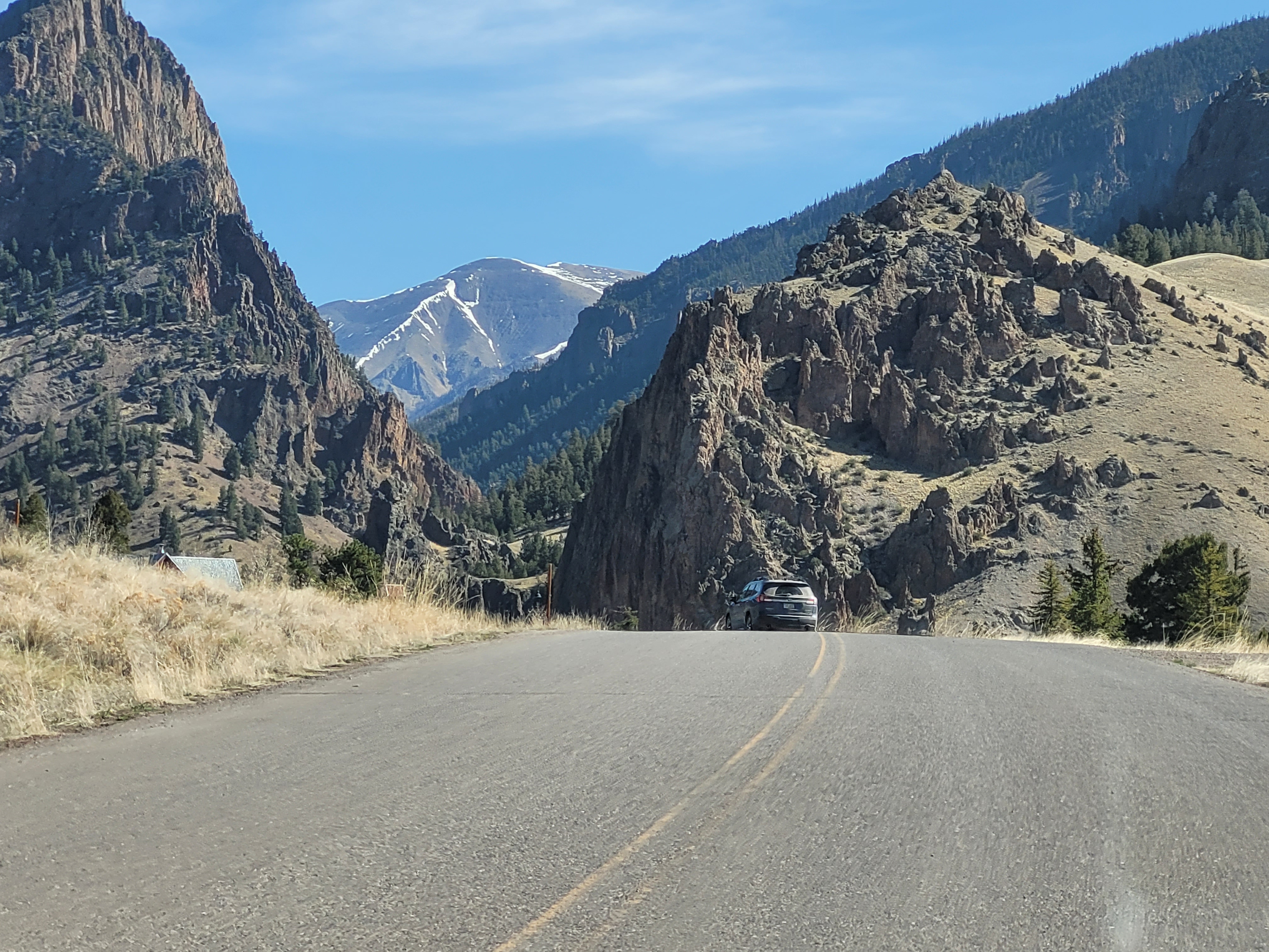
Coming in to Creede

What's left of the town of Bachelor City, CO. It was
developed as a suburb of Creede in the 1890s.
Despite being very active for a few years, the town
of Bachelor City was short-lived. By the turn of the
20th century, silver shortages sent inhabitants of
the town and its surrounding camps to Creede and onward.

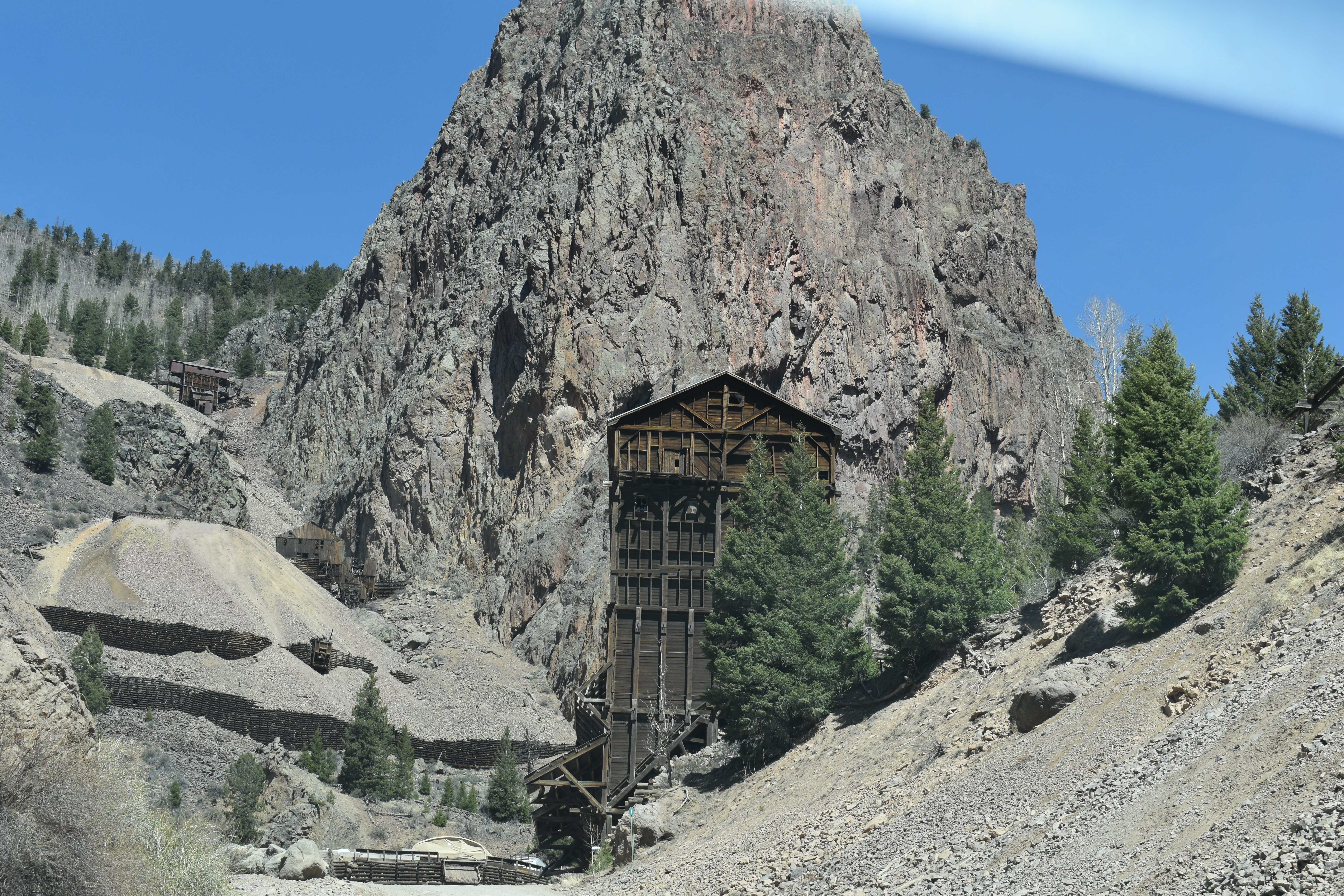
We drove part of the Bachelor Loop until the road got
too rough. There are the remains of several mines from
the 1890s Silver Boom.

Bachelor Loop Road

Bachelor Loop Road

Bachelor Loop Road

Bachelor Loop Road

Bachelor Loop Road

Creede, CO

Downtown Creede

Creede Fire Department is set back in
the mountain.

Commodore Mine - a silver, zinc and lead mine

Commodore Mine

Commodore Mine

Commodore Mine

Commodore Mine

Commodore Mine
Commodore Mine

Commodore Mine

Commodore Mine

Commodore Mine

Our niece and her husband are building a house
to the left of that house on top of that hill. They
will be able to see what's happening on Main Street!

Another view of Carol & Eddie's lot from the
Tommyknocker Tavern & BBQ Bistro

The ceiling of Tommyknocker Tavern

North Clear Creek Falls near Creede at
an elevation of 10,013'. It is a 100'
waterfall.
North Clear Creek Falls

Driving back to South Fork and the afternoon
fog/haze/smoke comes drifting in.
We got back to South Fork about 4:30 pm and went directly to the car wash for the third time this trip! This was another do it yourself place and Conrad made me stay in the car! We gassed up the car ($4.29 a gallon) and went back to the hotel. We ate supper out of our stash since we had a big lunch. We repacked everything, ready to leave in the morning.
Day 16 - Wednesday, May 4, 2022
We left the hotel at 7:30 and headed to the Great Sand Dunes National Park. We've been here before but wanted to see them again.
Against the backdrop of rugged 14,000-foot peaks, the Great Sand Dunes provide a stunning sight. Over 30 square miles of dunes appear as a "sea of sand" against the nearly vertical face of the Sangre de Cristo Mountains. The park contains the tallest sand dunes in North America. The "High Dune" is 750 feet above the valley floor.

Road to the Great Sand Dunes National Park

The Great Sand Dunes against the Sangre
de Cristo Mountains

The Great Sand Dunes against the Sangre
de Cristo Mountains

Great Sand Dunes National Park

The Sand Dunes and the San de Cristo Mountains

The Great Sand Dunes

The Great Sand Dunes - some of these people
are climbing up the dunes and others are
coming down on sand boards.

The Great Sand Dunes
The Great Sand Dunes

You had to cross the creek to climb the dunes.

The Great Sand Dunes

The Great Sand Dunes

Leaving the dunes

Snow fence in Colorado

Back to state #3

Raton, NM

Capulin Volcano - last erupted between 55,000 to
62,000 years ago. We climbed down in this when
we were through here in 2007. The irregular rim of
the crater is about a mile in circumference and the
crater is about 400 feet deep.

Farm in Capulin, NM

There was no "Welcome to Texas" sign so this
one will have to do for state #7

The first county in Texas

Dust storm in Dumas, TX

Our view of the Phillips Petroleum plant in Borger,
Texas from our motel room. Had to send this picture
to Darrell and Connie since he used to work there!
We stayed at the Royal Inn in Borger, Texas. The room was large with lots of space. We ate our supper from our grocery stash in the room. We're awfully tired and it's too much trouble to find a place to eat. We had eaten a big meal in Walsenburg, CO at the H & H Cafe. It was hard to find since the name wasn't on the building. It's one of those local places you walk in and everyone stares at you because you're not a local! There were two women waiting on tables and they did an excellent job and kept busy. The food was really good!
Day 17 - Thursday, May 5, 2022
We had some breakfast bars for breakfast and left the motel about 8:30. Our first stop was at the Alibates Flint Quarries National Monument. About 13,000 years ago, this site was already well-known by mammoth hunters as a place to get the best stone for their tools. Centuries passed but the colorful flint found here never lost its value and usefulness. Actually, an agatized, or silicified, dolomite, the flint is distinctive for its many bright colors. This flint comes from a 10-square-mile area around the monument, but most is concentrated on about 60 acres atop a mesa in the heart of the 1,000-acre monument. More than 700 quarries exist where this flint was dug out by hand. We toured the museum and Conrad spent time talking to the ranger there.

Flint Quarry area

Alibates Flint Quarries National Monument

Examples of the colorful flint found here.

The flint mined here comes in so
many colors!

In the museum - the answer?
Iron and Manganese!

A local guy made these points.

We walked this short trail.

Along the trail

We found several nice pieces of flint along the trail.
We were pretty much in the middle of nowhere after we left the Borger area. We found a small diner in Claude, Texas for lunch. We made our decision based on the two police cars who had also stopped here for lunch. We figured it must be good and it was!

I had a really good chicken salad with homemade
croutons on it.

Lots of nothing in Texas!

But it has a lot more green nothing than Oklahoma!

Hollis, Oklahoma

Coming in to Altus, Oklahoma
We checked in to the OYO Hotel in Duncan, Oklahoma for three nights about 4:30. We had a large room on the bottom floor and it was a big hotel. We never saw more than 4 cars in the parking lot who were hotel guests. There was a popular Mexican restaurant next door and they also used the hotel parking lot. Our room was really old and only had two electrical outlets - one behind the bed and one behind the tv. They did furnish a power strip from the plug behind the tv. There wasn't one at all in the bathroom area! But, the bed was pretty comfortable, the room was clean and we had air conditioning.
We decided to get out and drive around town some and relive those first six months of our married life! We lived in the Magnolia Manor Apartments. Our apartment is across the way, second floor on the left. The pool that was in the middle of the complex has been gone for many years. The apartments had central air when we lived there (June - December 1974) but I guess they replaced it with window units. We paid $160 a month, all utilities included except cable and phone.

Magnolia Manor Apartments

Our apartment, #44, second floor on the left.
.jpg)
Duncan Regional Hospital - where Brent was born the
second time we lived in this area. It was old then in 1978
and has been closed for a long time now.
.jpg)
This was my room. The room had the old crank up
bed. When it got cold in the room, you kicked the
board over the floor vent. If it got hot, you moved
the board!
We had a big lunch and weren't really hungry so we went to Arby's for supper. When we got back at the hotel, we had a hard time finding a place to park. Since it was Cinco de Mayo, I think the whole town was at the Mexican Restaurant next door.
Day 18 - Friday, May 6, 2022
We left the hotel about 8:00 to go to Lawton. Our first stop was at the Comanche Museum and Cultural Center. It was very well done and we learned a lot about the Comanche people.
.jpg)
We saw several prairie dogs in this park
near the museum.
.jpg)
More prairie dogs

Comanche National Museum & Cultural Center

Comanche National Museum & Cultural Center
About the Comanche women

Comanche dolls

Beautiful Comanche quilt

Kutsu in Comanche means buffalo -
All parts of the buffalo were used for something.

Interesting information about buffalo hide robes
.jpg)
Young Comanche boys
.jpg)
Young Comanche girls
.jpg)
Child's play for the Comanche children
.jpg)
Comanche Families
Next we drove over to nearby Medicine Park. It has a long history as a vintage cobblestone resort town. Many of the original structures are constructed of naturally formed cobblestones - these red granite cobblestones are unique to the Wichita Mountains.

One of the cobblestone houses

More cobblestone houses

We think these are vacation cabins on Medicine Creek.

Medicine Creek runs through the town and there
is a large swimming area.

Medicine Park Town Hall

We met a high school friend, Ann Peebles Gammill,
here at the Old Plantation Restaurant in Medicine
Park. They had really good food, but too much of it!
.jpg)
It was so good to see Ann again after about
48 years! She lives close to here.
Next we drove up to Mount Scott, a place we used to go to when we lived here. We lived here in southwest Oklahoma twice. The first time was when we got married, June 1974 until December 1974. We spent some time in Muskogee, OK and then Conrad was transferred back here to work at Waurika Lake. We lived in Comanche from January 1976 until April 1979 when we moved back to Arkansas. The Lawton/Mount Scott area was an hour or less away from where we lived. Mount Scott is part of the Wichita Mountains. Everything is so flat and then all of a sudden you see this pile of HUGE rocks! It looks like someone just dumped them there!

Driving up Mount Scott

The view from the top

At the top
The view from Mount Scott

From the top of Mount Scott

View from the top

View from the top
A beautiful view from the top

Here we are at the top!

Lots of buffalo roam free here in the refuge.
The next stop was at the Holy City of the Wichitas. It stands on a 66-acre area that looks much like Israel during Biblical times. Inside the city, you'll find numerous full-sized buildings and structures, including the temple court, the Lord's Supper building, Herod's Court and Pilot's judgment hall, all built with locally quarried granite in the 1930s. You can also explore areas designated as Calvary's Mount and the Garden of Gethsemane, in addition to watchtowers and perimeter walls.
This site is also home to the nation's longest-running annual Easter passion play. Attendance reached an all time high in 1939 when 225,000 visitors jammed Audience Hill for the sunrise performance.

Holy City of the Wichitas

The grounds

The grounds

Harod's Court

The Gateway to Jerusalem from the side

The Gateway to Jerusalem


World Chapel was built in 1936 and modeled after
America's oldest church, Christ Church in Alexandria,
Virginia where George Washington worshiped.

Inside the church

Inside the church

My favorite exhibit was about the prairie dogs.

A Prairie Dog town

A herd of longhorn cattle

A thirsty buffalo

Lots of longhorn cattle were brought in here to help
keep from becoming extinct.

Yes, please, walk out in front of my car!

Hot and tired buffalo
Day 19 - Saturday, May 7, 2022
Today we left the hotel about 7:30 and headed 10 miles south to Comanche. We lived here for about 3 years. We rented a house in the country for about a year and built our first house.

They are still the Indians!

This pump jack on the north end of town has
been there since 1918. This was the first well
discovered in the Comanche Oilfield.

And now they have a Sonic!

We attended First United Methodist
Church.

We were awfully proud of our first house! Some
renovations have been made. We had a covered
front porch and they extended the living room onto
that area. We also had a mailbox on the wall on
the front porch.

806 Walnut - They also added a privacy fence.
We didn't have a fence at all.
Conrad's first job out of college (and only job) was with the Corps of Engineers. He started out on an 18 month training program - 6 months in construction, 6 months in a power house and 6 months in the Tulsa district office. So, they sent us to the Waurika Lake project. They were building a 3-mile dam to dam up a creek that you could probably jump across! (The land is so flat out here.) It is now a beautiful 10,000 acre lake.

Waurika Lake

The project office where he worked

The dam and lake

Waurika Lake
.jpg)
Conrad studying the lake

Driving on the road behind the dam

We found these 4 youngsters fishing from
the stilling basin. One guy dropped his pole in
the water and as we left, he was climbing along
the top of the concrete and was going to jump
in to find it!

Waurika Lake
We had to drive through downtown Comanche a couple times. It's only a couple blocks long.

Downtown Comanche

Downtown Comanche

Back in Duncan, we ate lunch at Taco
Tico for old times sake!
We spent a couple hours at the Chisolm Trail Heritage Center in Duncan. This is a fairly new museum and very well done. There were a couple of theaters we visited. One was Campfire Theater with robot Jesse Chisholm talking trail history and the future with his acquaintance and first-time cowpoke, robot Tex. In the Experience Theater they showed a cattle drive. You could feel the vibrations of the cattle and feel the rain. There was also a Duncan General Store that showed what you could buy along the trail.

Chisholm Trail Heritage Center


Cattle Drive Map

Interesting facts about longhorns

Information on Driving Cattle

Early Oklahoma - We discovered that the
Panhandle is still No Man's Land!

Homesteaders had to list an occupation in
order to claim their section of land.
The last thing we did in the area is to drive around to a couple of the lakes where we used to go to swim and fish.

Humphrey Lake

Humphrey Lake

Clear Creek Lake
We headed back to the hotel to rest a bit and then went to eat at Buffet King for Chinese food. We repacked and loaded the car as much as possible since we are getting an early start home tomorrow. Jason was cooking Mother's Day lunch for us and for Jenny's parents and we told him we should be able to be there by 1:30.
Day 20 - Sunday, May 8, 2022
We got up at 5:00 and were gone by 5:45 a.m. It was pretty overcast the whole drive and real windy. We got to Jason's house at 1:00 for a delicious meal. We got back to our house about 4:00. We unloaded, unpacked and collapsed!

Looks like a storm is coming - Davis, OK

Sulphur, OK

So close! Two hours from home!

Guess what we have to do tomorrow?!