We left the hotel at 7:50 this morning and our first stop was at Sonic, just down the street! I hadn't seen one in about 2.5 weeks.
My happy place!
We were looking at the map for our route and I noticed that Red Rock Canyon and Hoover Dam, two places we wanted to see were almost on our route. So, why not take another detour? If we could visit these two places, we'd never have to go back to Las Vegas again! Being Sunday, it was easy driving through Las Vegas. Red Rock Canyon was gorgeous!
Red Rock Canyon lies within the Mojave Desert. North America's smallest, driest desert, the Mojave, is defined by its geology, elevation and characteristic plants such as Joshua trees.
The great sandstone cliffs at Red Rock, thousands of feet high, are made up of the Aztec Sandstone. This formation, about 180-190 million years old, is comprised of lithified sand dunes that formed in a vast desert that covered a large part of the southwestern U.S. during the Jurasic time. Lithification is the process of changing unconsolidated sediment into
sedimentary rock.
The conservation area showcases a set of large red rock formations, a set of sandstone peaks and walls called the Keystone Thrust. The walls are up to 3,000' high. A one-way loop road, 13 miles long, provides vehicle access to many of the features in the area.
Red Rock Canyon
Red Rock Canyon
Red Rock Canyon
Red Rock Canyon
Red Rock Canyon
Red Rock Canyon
Red Rock Canyon
Red Rock Canyon
Red Rock Canyon - Calico Hills Overlook
Red Rock Canyon - Calico Hills Overlook
Red Rock Canyon
Red Rock Canyon
Tortoise at Visitor Center
Red Rock Visitor Center
This jackrabbit was just outside the
Visitor Center
Then, it was off to Hoover Dam and Lake Mead. Lake Mead is on the Colorado River. It is the largest reservoir in the U.S. in terms of water capacity. Formed by the Hoover Dam, the reservoir serves water to the states of Arizona, California and Nevada. As of August 2017, Lake Mead was at approximately 40% of full capacity due to drought. It has not been full since about 1986.
Lake Mead
Lake Mead
Hoover Dam was completed in 1935 at a cost of $50 million, and Lake Mead filled up behind it. We had to go through a security check point going to the dam. We wanted to walk up on the bridge overlook that was completed in 2010 at a cost of $114 million. It was SO windy on the bridge! At one point, I tried to take a step forward but couldn't move! We had a great view from here though. It was almost too windy to even take a picture - you couldn't hold the camera still. I was able to get a couple pictures though.
Hoover Dam from pedestrian bridge
Hoover Dam from pedestrian bridge
The Hoover Dam bypass bridge is not just any bridge. Soaring 890' above the Colorado River it's the second-highest span in the U.S. And as much as it was constructed for cars and trucks, the bypass bridge was built for sightseers too. From it's 6' wide sidewalk, pedestrians have a grand view of the famous concrete dam, just 1,600' upstream.
This picture of the bridge came from Wikipedia.
The building of the Hoover Dam
The lakeside of the dam
Hoover Dam
Hoover Dam
Bridge at Hoover Dam
Big horn sheep at Visitors Center at Hoover Dam.
We also saw a coyote here.
We also saw a coyote here.
Back on the road again and on schedule, we saw this dust devil in the middle of a field. It was a really windy day.
Dust devil
The town of Cal Nev Ari, Nevada - on Hwy 95
south of Las Vegas, near the California/Nevada/
Arizona state lines.
We crossed back in to California and got on I-40 to Needles then on to Topock, Arizona. This is where we got on Route 66 and followed it up to Oatman.
Arizona - state #11
Along Route 66
Along Route 66 - gives a whole new meaning
to "move your ass"!
Along Route 66
Along Route 66
Along Route 66
Along Route 66
Along Route 66
Along Route 66
In 1917 Oatman's population was about 5,000. The death blow to Oatman was dealt in 1942 with a government order to close the gold mines. Since the veins of ore ran dry in 1942, crusty Oatman has reinvented itself as a movie set and Wild West tourist trap, complete with staged gun fights and gift stores named Fast Fanny's Place and the Classy Ass. Speaking of asses, there are plenty of them, the 4 legged kind, roaming the streets. Stupid and endearing, they're the descendants of pack animals left by the early miners.
Oatman, Arizona
Oatman, Arizona
Oatman, Arizona
The big, white rock landmark in Oatman is called Elephant Tooth. The gold mine was located on the west slope of the Black Mountains at the foot of Elephant Tooth.
Elephant Tooth, Oatman, Arizona
Oatman, Arizona
Oatman, Arizona
Oatman, Arizona
Oatman, Arizona
Route 66 - north of Oatman
Route 66 crosses the top of the Black Mountains via Sitgreaves Pass (elevation 3,523 ft) - a ridge that has great views.
Sitgreaves Pass
Sitgreaves Pass
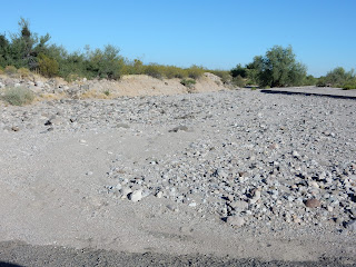
Along Route 66 - when it rains, water gushes
through here and floods the road.
We checked in to our hotel in Kingman - the Ramada Kingman. The cost of the room with tax was $77.52. We only drove 296 miles today. We ate dinner in the dining room at the hotel.


No comments:
Post a Comment